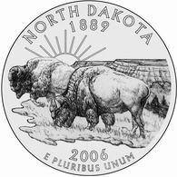
First Dakota


On February 22, 1889, Congress passed The Enabling Act of 1889, allowing the areas of Washington, Montana, North Dakota, and South Dakota to set up legislatures for the purpose of, in the near future, becoming states. In November of that year, all four entered the Union: the Dakotas on November 2, Montana on the 8th, and finally Washington, three days later — in total, raising the number of states from 38 to 42.
But which Dakota was number 39? No one knows.
Both states, pre-statehood, made up Dakota Territory, which existed in some shape or form from March of 1861 until the Dakotas became states. While admitting Dakota as one state was an option, a few factors lead to its split. First, the territory had, at the time, a relatively large population. Second, the population was focused on two areas — in the northeast and southeast corners of the territory, respectively — hundreds of miles from each other. And politically, the Republican Party, which had control of the Federal government, wanted two states (and therefore four Senate seats) instead of two. All together, this lead to the aforementioned Enabling Act dividing the territory into two, North and South.
The problem? Both North and South Dakota wished to become a state before the other, perhaps as an attempt to be the “true” Dakota. And as a matter of practical reality, one had to be first, as the final mechanism for becoming a state requires the President of the United States sign an order to that effect, making simultaneous admission impossible. But President Benjamin Harrison had an idea. He requested that his Secretary of State, James Blaine, shuffle the admission documents and obfuscate which was which. Harrison signed both on November 2, 1889, without any knowledge as to which he signed first. To the extent that Blaine knew which order was signed first, he never let on. To date, and likely forever, no one knows which Dakota entered the Union first.
Yet North Dakota may have gotten the last laugh: By virtue of being alphabetically before South Dakota, it is often listed first, as a matter of convenience.
Bonus fact: North Dakota won something during the split: the geographic center of North America, located here. But in 1959, after Alaska and Hawaii became states, South Dakota gained a counter-balance: the geographic center of the United States. (The geographic center of the contiguous 48 states is near Lebanon, Kansas, and has a large marker denoting its significance.)
From the Archives: Pumping the Phone: How South Dakota is part of a (legal) telephone scam.

Leave a comment