Proof That Trivia Can Save Lives?
Long drives can be boring. Your goal is usually to get to where you’re going; in most cases, the drive itself is just a means to an end. And when steering a vehicle going 60 miles per hour, boredom can be a killer. To combat this, we’ve come up with all sorts of ways to keep drivers aware and awake as they make these trips. Cars typically come with radios and sound systems, to give you something to listen to on your trip. Many cars can now detect if you’re swaying out of your lane and suggest you pull over for a cup of coffee. And for most drives, there’s something to look at out the windows — nature, buildings, or the license plates of other cars.
But for long drives through the middle of nowhere, particularly if you’re alone, most of these tactics don’t work. You may not have great radio reception and besides, that goes boring after a while. There may not be much to look at, either. It’s easy to see a situation where a driver can become so bored, they just doze off and meander off the road, creating all sorts of danger. And in one particular road in Australia, that happens all too often.
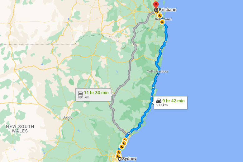
Pictured above is Google Maps’ recommended routes if you’re driving from Sydney to Brisbane. The blue route — the one Google Maps suggests first — is shorter and probably more enjoyable, as it travels up the coast through more populated areas. But it’s not the only route available. If you have a destination somewhere inland, the grey route may be a better option. But it’s longer — an additional 64km (40 miles) — and will keep you in the car for nearly an additional two hours. And for most stretches, there’s not a lot to look at it. Here’s a screenshot from one section of two sections of the road separated by about 2.3km (about a mile and a half).
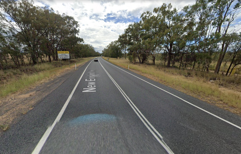
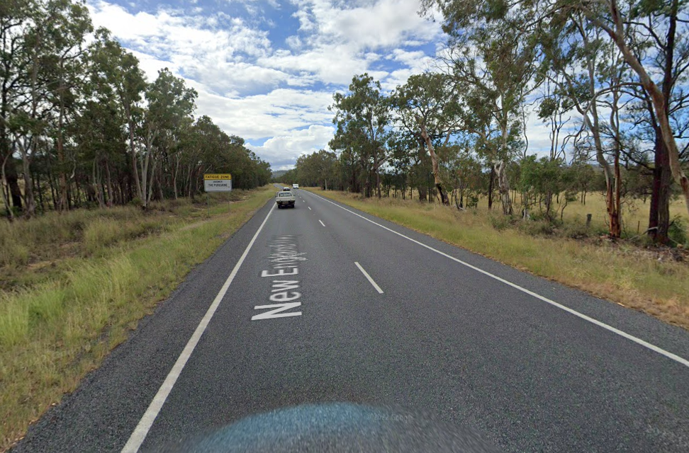
Some trees, lots of grass, a sign, and the road itself. And not much to distinguish one picture from the other — if you didn’t know better or look closely at the details, you’d probably think that the pictures were taken at the same place and time, not a few kilometers apart.
But if you do look closely, you’ll see that the signs are different — and not just different from one another. The signs aren’t there to give you directions or anything like that. They’re designed to keep you awake: by playing a game with you. A quiz game. Let’s zoom in on the first Google Maps screenshot (or click here to see it on Google Maps itself).
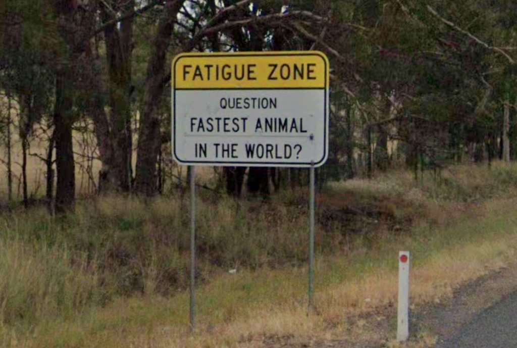
And if you don’t know the answer, don’t worry! A few minutes later, another sign will give it to you. (Here’s the map link for that one.)
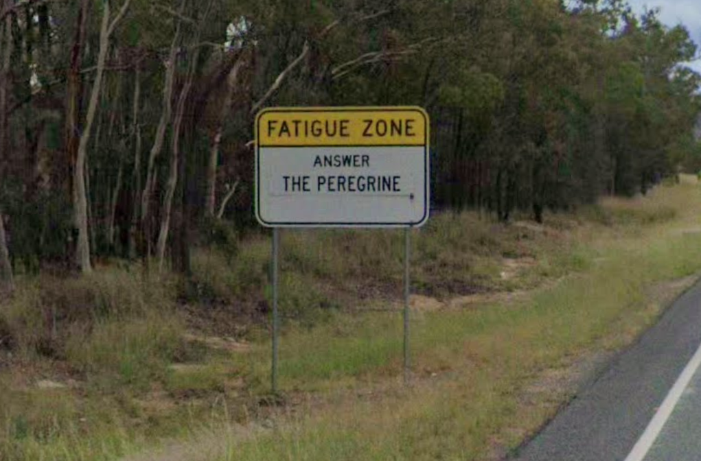
(The peregrine is a falcon, and it’s the fastest because it dives down from the sky really, really quickly. According to Vox, “reaching speeds of more than 200 miles per hour, peregrine falcons can dive faster than a moving Formula One race car.” If you thought the answer what “the cheetah,” they max out at about 80 miles per hour.)
The signs don’t come out of nowhere; a bit before you get to the questions, you’ll see another one saying “Fatigue Zone: Trivia Games to Help You Stay Alert,” as seen here. The government updates the signs occasionally to help keep the trivia fresh, too, so if you’re on that route more than occasionally, there’s a good chance you’ll learn something new on a subsequent trip. If you want to see more of the signs, without having to travel to this Australian highway, Bored Panda has some photos, here.
There haven’t been any studies on the efficacy of the signs, but if you’re reading a trivia newsletter — and you are! — you’re probably open to the idea that trivia is interesting enough to keep you alert. Who knew it could potentially save lives, too!
Bonus fact: If you’ve driven a long distance but afterward, don’t really remember doing it, don’t worry — you’re not alone. It’s so common that some researchers have a name for it: “highway hypnosis.” The theory, as summarized on Wikipedia, holds that in this state of mine, “the driver’s conscious mind is apparently fully focused elsewhere, while seemingly still processing the information needed to drive safely.” But it’s only a theory — there’s no great way to study it — and even if it exists, it is still dangerous. From the driver’s perspective, it’s difficult at best to tell if you’re just zoned out or actually getting sleepy. And even if you aren’t actually tired, you’re still not paying enough attention to be safely behind the wheel. As one law firm points out, “the brain is not fully aware or conscious of what is happening on the road. Reaction time is slowed, increasing the risk of an accident.”
From the Archives: The Isolated Tree: A tree in the middle of nowhere proves that car accidents can happen anywhere.