The Roads to Citizenship

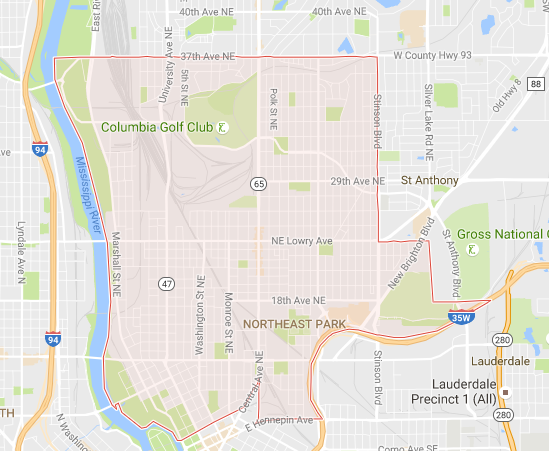
The area of Minneapolis known as “Northeast” (above) is a one of eleven official, City Council recognized “communities” — groups of neighborhoods — which collectively make up the largest city in the state of Minnesota. Northeast was first settled in 1848, incorporated as its own city (called St. Anthony) in 1855, and merged into Minneapolis in 1872. In its early days, both as St. Anthony and then as part of Minneapolis, Northeast was a manufacturing hub, supporting the region’s lumber and flour milling industries. As a result, it became an attractive location for immigrants. By the early 1900s, Northeast, per Wikipedia, immigrants made up as much as 60% of the area’s population.
It behooved the area to have those residents earn the right to vote, which meant that the immigrants had to become citizens. Becoming a citizen involved, among other things, passing an exam about the United States, its government, and its history. And learning the names of the Presidents of the United States — that was something good to do if you wanted to become a citizen.
So, Northeast found a way to help. When St. Anthony merged into Minneapolis, town planners began building the information into something residents were going to learn anyway — the new street map.
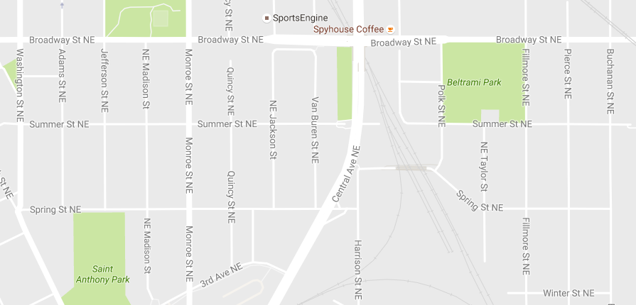
As seen above, the streets, from west to east (with some zigs and zags) are named after the Presidents, in order of their taking office, running from Washington to Buchanan. If you go a bit further east, you’ll see more presidents — all the way until you hit Hoover Street, named after the 31st President, Herbert Hoover. President Hoover’s term in office ended in 1931 — at about the same time the immigrant population in the area hit its apex.
It’s a neat little idea — using the map to teach civics — but it’s not perfect. For example, in one part of Northeast, there’s a Howard Street between Madison and Monroe — and Howard wasn’t the fourth-and-a-half President of the United States. The road named after President John Quincy Adams is simply “Quincy Street” and the one after President Benjamin Harrison is “Benjamin Street.” And there’s a Washington Avenue in Minneapolis, but if you’re on Washington Street, it’s a bit of a drive.
And we don’t know if it worked, either. Knowing the order of the Presidents is a good piece of trivia to have at one’s disposal, but as civics goes, it’s only one item and not one of the more important ones at that. Perhaps roadways named after the freedoms protected by the Bill of Rights would have been more useful, but “No Quartering Soldiers in Private Houses During Peacetime Boulevard” doesn’t quite roll off the tongue.
Bonus fact: According to an organization called The Trust for Public Land (“the nation’s largest national nonprofit organization working to create and improve neighborhood parks” which “believes that everyone should live within easy walking distance of a well-maintained park”), Minneapolis is the top U.S. city when it comes to public park access. A large reason why? Per CityLab, “ninety-four percent of people in Minneapolis live within a 10-minute walk of a park.”
From the Archives: Where the Streets Have Your Name: A city that’s a map of the Simpsons. Except the map came first.
Take the Quiz: The U.S. Citizenship and Immigration Services offers a practice citizenship exam. Can you pass it?
Related: Flashcards to get you ready for that citizenship exam (or to make you feel better if you failed that practice one.)